
Leading Africa's geospatial revolution with precision drone technology and innovative surveying solutions
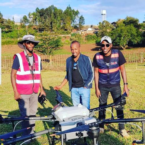
Founded in 2015, Geo-Cart has emerged as Kenya's premier drone surveying and geospatial intelligence company, serving clients across multiple African regions. Our journey began with a vision to transform traditional surveying methods through cutting-edge drone technology.
Today, we stand at the forefront of the geospatial industry, combining advanced drone systems, LiDAR technology, and expert data analysis to deliver precise, actionable insights for engineering, construction, environmental management, and urban planning projects.
Our team of certified surveyors, drone pilots, and data scientists work collaboratively to push the boundaries of what's possible in geospatial data collection and analysis.
Get In Touch
"To be the world's most client-centric company in Surveying & Drone Solutions"
"To empower engineering, planning, and decision-making using data-driven, drone-powered geospatial intelligence."
We deliver centimeter-level accuracy in all our surveys, ensuring reliable data for critical decisions.
Continuously adopting and developing cutting-edge technologies to solve complex geospatial challenges.
We maintain the highest ethical standards in all our operations and client relationships.
Your success is our priority. We tailor solutions to meet your specific project requirements.
Consistently delivering on promises with quality results and timely project completion.
At Geo-Cart, we believe in strengthening the geospatial ecosystem through strategic partnerships with leading academic institutions. Our collaboration with the University of Nairobi represents our commitment to knowledge sharing and capacity building.
Through this partnership, we:

Our expertise and services extend throughout Eastern, Central, Southern Africa and the Horn of Africa, delivering precision surveying solutions where they're needed most.

Our diverse team brings together expertise in surveying, drone technology, data science, and project management.

Registered surveyor with 15+ years experience in geospatial technology and drone applications.

PhD in Geospatial Engineering, specializing in LiDAR data processing and analysis.

Certified drone pilot and project management professional with extensive field experience.
Partner with Geo-Cart for accurate, reliable surveying solutions that drive informed decision-making.
Start Your Project