
Comprehensive drone surveying and geospatial solutions tailored to your project needs
At Geo-Cart, we leverage cutting-edge drone technology and advanced surveying techniques to deliver accurate, reliable data for a wide range of industries and applications. Our comprehensive service portfolio is designed to meet the evolving needs of modern engineering, construction, and environmental projects.
Traditional and advanced land surveying for precise measurement and mapping

Comprehensive land measurement and topographic surveys for engineering design, construction layout, and property development.
Site planning, construction stakeout, earthwork calculations, and as-built verification for infrastructure projects.
Detailed terrain modeling and boundary determination for accurate land representation and legal documentation.
Property dispute resolution, land subdivision, cadastral mapping, and development planning.
Official boundary surveys for property registration, land titles, and legal land division according to national standards.
Land title registration, property transfer, lease documentation, and resolving boundary disputes.
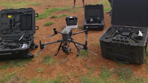
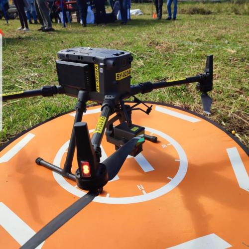
Advanced aerial data collection and analysis using cutting-edge UAV technology
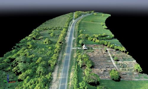
High-precision topographic mapping using drone-mounted LiDAR sensors for accurate 3D terrain modeling even through vegetation.
Flood modeling, power line corridor mapping, forestry inventory, and mining volume calculations.

High-resolution orthomosaic maps and 3D models created from overlapping aerial imagery captured by drones.
Construction progress monitoring, quarry volume calculations, site documentation, and urban planning.
Immersive 3D models and virtual tours created from drone data for enhanced project visualization and stakeholder engagement.
Real estate marketing, tourism promotion, heritage documentation, and project stakeholder presentations.
Advanced analysis of spatial data to extract meaningful insights, patterns, and trends for informed decision-making.
Site suitability analysis, environmental impact assessment, urban growth monitoring, and agricultural optimization.
Safe, efficient infrastructure assessment using specialized drone technology

Comprehensive inspection of power lines, transmission towers, and utility infrastructure using specialized drones and sensors.
Preventive maintenance planning, fault detection, vegetation encroachment monitoring, and asset inventory.

Detailed structural assessment of bridges, buildings, and critical infrastructure using high-resolution drone imagery.
Bridge condition assessment, building facade inspection, dam safety evaluation, and historical structure documentation.

Regular monitoring of construction progress and structural deformation using time-series drone data collection.
Construction progress tracking, stockpile volume monitoring, structural settlement measurement, and compliance verification.
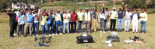
Developing the next generation of geospatial professionals
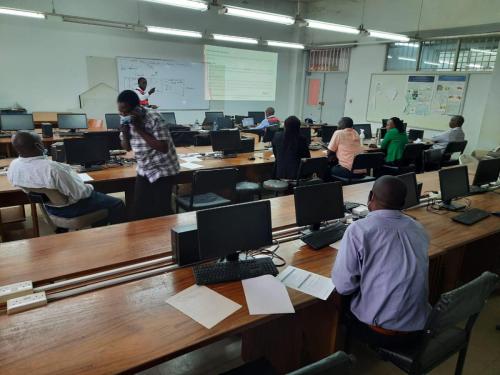
Comprehensive drone pilot training programs covering flight operations, safety procedures, and regulatory compliance.
Professional drone pilot certification, organizational capacity building, and academic institution curriculum development.
Specialized training in processing and analyzing drone-captured data using industry-standard software and techniques.
Surveying firms upgrading to drone technology, GIS professionals expanding skills, and academic research teams.
Customized training programs for organizations looking to build internal capacity in geospatial technologies and applications.
Government agencies, utility companies, construction firms, and environmental organizations building geospatial teams.
Our team can tailor any service to meet your specific project requirements and deliver the precise data you need.
Get a Custom Quote