Surveying Drone 3D Mapping Drone Training Topographic Mapping

Geo-Cart Surveyors

0
Projects Completed
0
Clients in Africa
0
Customer Satisfaction
0
African Regions Served

Our Specialized Surveying Solutions

Delivering precise geospatial intelligence through advanced surveying technologies.

Drone LiDAR Surveys

Drone LiDAR Surveys

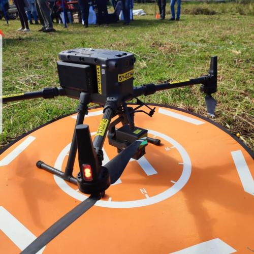
High-precision terrain mapping using drone-mounted LiDAR for engineering, planning, and modeling.

Learn More
Engineering & Land Surveys

Engineering & Land Surveys

Accurate land measurements for infrastructure, real estate development, and legal documentation.

Learn More
Utility Inspection

Utility & Infrastructure Inspection

Drone-based inspections of pipelines, power lines, and infrastructure for risks and compliance.

Learn More
3D Mapping & Modeling

3D Mapping & Modeling

Create detailed digital 3D terrain models for construction, planning, and visualization.

Learn More
Drone Training

UAS/Drone Training

Professional drone operation and data processing training for individuals and organizations.

Learn More
Geospatial Analytics

Geospatial Data Analytics

Transform raw geospatial data into actionable insights for strategic planning.

Learn More

Industries We Serve

Construction

Mining

Energy

Education

Government

Agriculture

Environment

What Our Clients Say

John Mwangi
Geo-Cart helped us collect detailed terrain data for a 240-acre site in 48 hours—something that usually takes 3 weeks with traditional methods.
John Mwangi
Project Engineer, LAPSSET Authority
Mary Wanjiku
Their drone LiDAR surveys saved us significant time and costs during our infrastructure development project.
Mary Wanjiku
Survey Manager, Nairobi Metro
Peter Ochieng
The 3D mapping solutions provided by Geo-Cart were extremely accurate and helped us plan our construction efficiently.
Peter Ochieng
Civil Engineer, Rift Valley Construction

Need Precise and Reliable Survey Data?

Let's discuss how our drone surveying solutions can provide the accurate data you need for your project.